Where did Antarctica go?
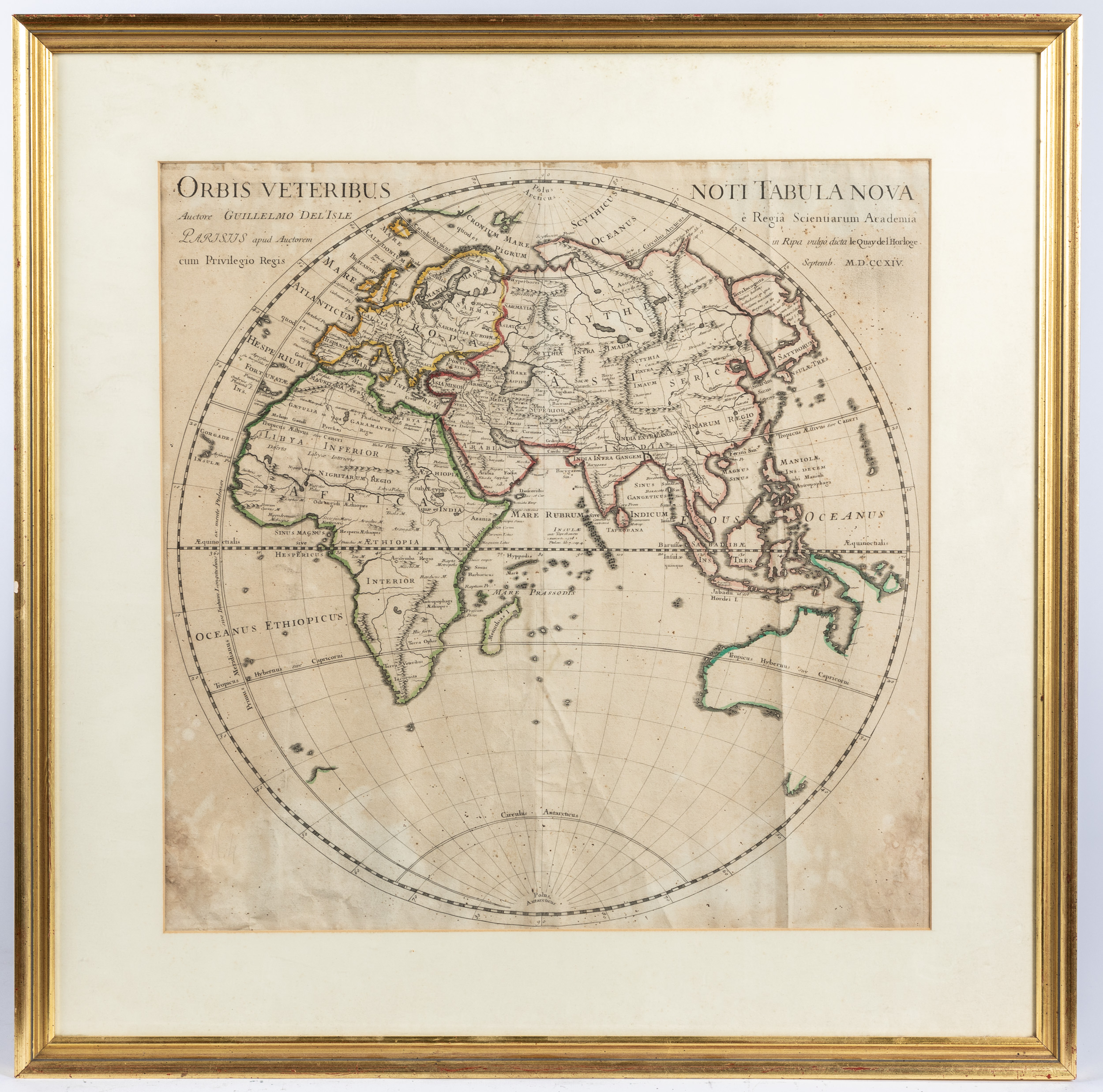
Tucked away in a corner of our upcoming May Online Only Decorative Arts auction we have a real treasure map! Or at least, it’s a really treasured map. An engraved map of the Western Hemisphere with hand-colored borders published in 1714 by Guillaume De L’Isle during his career at Quai de l’Horloge (Clock Tower Quay, in English), a publishing hub in Paris where he lived and worked. Guillaume was arguably the most influential of the French cartographers and retains a legacy of accuracy in his maps that were unparalleled at the time, most likely due to his studying mathematics under Cassini – the same Cassini who discovered four of Saturn’s moons and for whom a NASA spacecraft was named. Guillaume set the standard for accuracy with his longitudinal and latitudinal recalculations and incorporated his measurements into his maps, a habit quickly adopted by all other cartographers of the time and thereafter. Guillaume was so influential he became the Premier Geographe du Roi (or the Cartographer of the King) four years after this very map was made!
If you look closely, you’ll see that Australia isn’t entirely filled in. They still had unfinished corners of the map at that time. Imagine the excitement when new cartographical information was brought back by explorers to France and cartographers quickly started working on mapping out the newest part of the world, the most accurate map ever made gradually becoming more and more complete!
More astute cartographical nerds will also notice the complete lack of Antarctica. This is because at the time of this map’s making no one had even crossed over into the Antarctic Circle. No one would even see the Antarctic continent until 1820, nearly one hundred years later. What an incredible time of adventure this map comes from. In this case, the buried treasure was the map we had with us all along.
by: Jackson Ryan


